
الوجهات
Lake Como Shores: Carate Urio, Pognana, Nesso
Carate Urio, Pognana Lario and Nesso sit on two different shores of the Como branch of Lake Como, and the shore sets the road, the ferry, the direction of the light and how steeply the land meets the water. This note compares the three on published facts, labels what is only geometry, and lists what no desk study can settle.
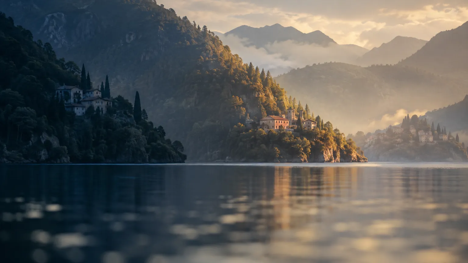 رسم توضيحي
أبرز النقاط
- - Carate Urio is on the western shore of the Como branch, Pognana Lario and Nesso on the eastern shore (Navigazione Laghi stop list via Salimar Boat, Como to Bellagio 2026, published).
- - Straight-line distance from Como is about 6 km for Carate Urio, 9 km for Pognana Lario and 13 km for Nesso (Wikipedia EN comune entries 2026, directional).
- - The lake surface sits at 197.39 m, the maximum depth between Argegno and Nesso is given as 412 m in the summary table and 418 m in the text, and the width is 650 m at its narrowest (Wikipedia IT, Lago di Como 2026, encyclopedic).
- - The western shore runs on the SS340 Regina, the eastern on the SP583 Lariana, 49.4 km from Como to Pescate, with the Como to Bellagio section built 1911 to 1917 (Wikipedia IT, Strada statale 583 Lariana 2026).
- - Como lies about 40 km north of Milan and Como San Giovanni is 46.6 km from Milano Centrale by rail, while no rail journey time was verified (Wikipedia EN, Como, and Wikipedia IT, Ferrovia Milano-Chiasso 2026, encyclopedic).
- - Como has about 8 h 40 min of daylight on 21 December 2025, sunrise about 08:02 and sunset about 16:42 on a flat horizon, and shading on the shores is not measured (sunrise-sunset.org, Como December 2025, directional).
- - Residents at 1 January 2026 are 1,074 in Nesso, 657 in Pognana Lario and 1,090 in Carate Urio, a derived sum of 2,821 (ISTAT data via Tuttitalia 2026).
- - As of 4 October 2026 a Navigazione Laghi notice reports the Faggeto Lario landing temporarily suspended from 5 October 2026 with no end date, so a landing is an option and not a guarantee (Navigazione Laghi notices, 2 October 2026).
في هذه الصفحة (11)
Which shore of the Como branch is each place on?
Carate Urio is on the western shore of the Como branch, while Pognana Lario and Nesso are on the eastern shore. The ferry operator's stop list places Carate Urio between Moltrasio and Laglio on the west. It places Pognana Lario, Careno, Nesso and Lezzeno on the east. That single fact drives most of what follows.
The eastern shore belongs to the Triangolo Lariano. This is the wedge of land between the Como branch and the Lecco branch. The English encyclopedic entry for Nesso describes the municipality as sitting on the western coast of that wedge. The road on this side is the SP583 Lariana, not the SS340 Regina. The two shores share a lake and a ferry line. They do not share a road.
The shores face each other across a narrow gap. The Como branch narrows to 650 m between Careno and Torriggia, according to the Italian encyclopedic entry for the lake. Careno is the landing between Pognana Lario and Nesso on the stop list. A house on one shore looks at the slope of the other, and each shore's winter light is shaped by the mountain opposite.
Municipal borders ignore the shore. The English encyclopedic entry lists Torno and Faggeto Lario, both eastern-shore comuni, among the neighbours of Carate Urio, which is on the western shore. Pognana Lario lists Laglio, a western-shore comune, as a neighbour. The water is shared administrative territory. The principal should read the shore as a physical fact and the comune as a legal one.
One note replaces three because the comparison is the point. Three thin notes would repeat the same lake three times. A single note lets the allocator set the shores side by side, which is the only comparison that matters for these three places.
What is the Como branch, and how big is the basin?
*The Como branch is the south-western arm of Lake Como, ending at the city of Como.* Lake Como is an inverted Y with three arms that meet at the Bellagio promontory. The Como branch runs from Bellagio south-west to Como. All three places in this note sit on it.
The basin is deep, and a single source gives two figures for its depth. The Italian encyclopedic entry gives a maximum depth of 412 m in its summary table and 418 m in its text, and places the deepest point between Argegno and Nesso. The allocator should read this as more than 400 m, a directional figure, because the source does not agree with itself to the metre. Nesso sits at one end of the deepest stretch. That is a published physical fact and says nothing about value.
The water level moves by about two metres over a year. The same entry gives the surface altitude as 197.39 m above sea level, with a seasonal swing of roughly two metres driven by snowmelt and autumn rain. That swing matters at the waterline. Jetties, boat ramps and lower terraces are designed around it. A photograph taken in one season does not show the other.
The shape of the basin explains the character of both shores. A basin that is 650 m wide at its narrowest and several hundred metres deep is a steep trough, not a shallow bowl. The two figures come from different points, so the principal should not divide one by the other. They do indicate steep banks, which is directional and unmeasured at plot level.
Three terms are used in a fixed sense in this note. The shore is the line where the comune meets the lake. Winter sun means direct light around the December solstice. Straight-line distance means the distance on a map, not a drive. Each term is labelled again where it is used, with its grade.
How far are Carate Urio, Pognana Lario and Nesso from Como and Milan?
By straight line, Carate Urio is about 6 km from Como, Pognana Lario about 9 km and Nesso about 13 km. These are the figures the English encyclopedic entries give, all measured to the north-east of Como. They are map distances and a directional proxy. Nobody reaches these places in a straight line, because the lake is in the way.
Milan sits beyond Como, so every journey has two legs. The English encyclopedic entry for Como places the city about 40 km north of Milan, and the Italian entry for the Milan to Chiasso railway puts Como San Giovanni 46.6 km from Milano Centrale. No rail journey time could be verified from an open page for this note.
The station is in Como, not on the shore. The S11 line links Rho to Como San Giovanni via Milano Porta Garibaldi. One timetable listing describes a train every 30 minutes on the line, with one train an hour reaching Como San Giovanni and the others ending at Carimate. From the station to a shore address the principal still needs a car, a bus or a boat. The rail time is the first leg and never the full journey.
Carate Urio has the shortest shore leg, Nesso the longest, and the spread is 7 km on the map. On a narrow road the map distance understates the time, and the gap widens with traffic. No measured drive time for the three places was verified for this note. Anyone relying on a commute must drive the route at the hour that matters.
The honest comparison is ordinal. Carate Urio is closest to Como. Pognana Lario is in the middle. Nesso is furthest from Como, and only Lezzeno lies between it and Bellagio on the eastern stop list.
| Item | Carate Urio | Pognana Lario | Nesso |
|---|---|---|---|
| Shore of the Como branch (published) | Western | Eastern | Eastern |
| Faces (directional, from branch orientation) | East, morning light | West, afternoon light | West, afternoon light |
| Winter sun (directional, not measured) | Likely keeps the morning, loses the evening to the western mountains | Likely keeps the afternoon, loses the morning to the eastern mountains | Likely keeps the afternoon, loses the morning to the eastern mountains |
| Distance from Como, straight line (encyclopedic, directional) | About 6 km | About 9 km | About 13 km |
| Distance to Milan (encyclopedic, directional) | Via Como, about 40 km Como to Milan plus the shore leg | Via Como, about 40 km Como to Milan plus the shore leg | Via Como, about 40 km Como to Milan plus the shore leg |
| Road access (published) | SS340 Regina | SP583 Lariana | SP583 Lariana |
| Ferry landing on operator stop list (published) | Yes | Yes | Yes |
| Altitude of comune centre (Wikipedia EN / Tuttitalia, sources differ) | 199 m / 207 m | 307 m / 280 m | 315 m (Tuttitalia), shore at 199 m |
| Residents, 1 January 2026 (ISTAT via Tuttitalia) | 1,090 | 657 | 1,074 |
What does road access look like on the SS340 Regina and the SP583 Lariana?
The western shore runs on the SS340 Regina, and Carate Urio is on it. The provincial page on the Tremezzina variant describes long travel times through inhabited centres and bottlenecks, and the Italian encyclopedic entry for the road describes a single carriageway with points so narrow that no lane division exists. The provincial page places the congestion between Argegno and Menaggio, which is north of Carate Urio. The village sits on the Como side of it.
The Tremezzina variant is a response to that bottleneck, and it is far to the north. The provincial page describes a tunnel 2,730 m long as part of the project. It does not change the road at Carate Urio. It matters here only because it shows that the authorities judged the Regina's capacity problem serious enough for a tunnel.
The eastern shore runs on the SP583 Lariana, a provincial road. The Italian encyclopedic entry calls the route extremely panoramic but narrow, undulating and full of bends. It passes Blevio, Torno, Faggeto Lario, Pognana Lario, Nesso and Lezzeno before reaching Bellagio. The Como to Bellagio section was built between 1911 and 1917, and the full Como to Pescate route is 49.4 km.
Both roads were laid out for a different traffic. A route built between 1911 and 1917 now carries 2026 volumes through small villages. The allocator should read the road as the binding constraint on daily access. Deliveries, builders and guests all arrive on it, and it has no second lane to spare.
Heavy-vehicle limits are a live issue on the Regina. A local news report of 5 March 2025 says an ANAS ordinance on the Colonno to Tremezzina section became permanent, applying each year from 15 March to 15 November, with time windows for vehicles over 9.1 m and over 11 m that differ by direction and vehicle type. That section is north of Carate Urio, and the current status was not checked beyond that report. A principal planning works on either shore must ask the comune about vehicle limits, delivery windows and works closures.
Can the ferry replace the road at Carate Urio, Pognana Lario or Nesso?
Each of the three places has a landing on the Navigazione Laghi stop list. A ferry guide lists Carate Urio among the western stops, and Pognana Lario, Careno and Nesso among the eastern ones. The slow boat from Como to Bellagio is reported at about two hours. The ferry is a second access, a scenic one and a slow one.
The ferry cannot be assumed to stop where the guide says. As of 4 October 2026, a Navigazione Laghi notice dated 2 October 2026 says the Faggeto Lario landing is temporarily suspended from 5 October 2026 for reasons not depending on the operator, with no end date given. Faggeto Lario is the stop before Pognana Lario on the eastern list. Stops can close, and a closure can last.
A landing is an option, not a commute. Two hours from Como to Bellagio on the slow boat means the principal measures the ferry in half-days. A residence that depends on a daily boat is a different asset from one on a road with a rail station reachable by car.
Frequency, season and vehicle capacity are not verified here. The ferry guide gives the slow-boat duration and the stop list. It does not give a winter timetable for the three landings. The allocator should obtain the operator's current timetable for the exact landing and read the winter columns first.
A landing is public infrastructure at the waterline. It says nothing about the land above it. The principal should not read a landing as evidence of value.
How much winter sun does each shore of the Como branch receive?
Directionally, the western shore gets morning sun and the eastern shore gets afternoon sun, and neither is measured here. The Como branch runs south-west from Bellagio, so the western shore faces east and the eastern shore faces west. On that geometry, the western shore catches the first light and loses the evening sun behind its own slope, while the eastern shore loses the morning and keeps the last sun of the day. This is a Victaura Research assumption from orientation, not a measured result.
The sun is scarce everywhere in December. At Como on 21 December 2025 the day lasts about 8 hours 40 minutes, with sunrise at about 08:02 and sunset at about 16:42, according to sunrise-sunset.org. Those are flat-horizon values. On a steep lake shore the mountains remove more light, and the amount removed differs at each address.
No source read for this note measures winter shading on either bank. The travel guide cited here describes the orientation of towns elsewhere on the lake, not shading on the Como branch. On geometry alone, a western address loses the evening sun behind the slope, and an eastern address on the SP583, with the slope rising behind it, loses the morning.
The choice of shore is a choice about which half of a short day to keep. On geometry alone, Carate Urio should keep the morning. Pognana Lario and Nesso should keep the afternoon and the evening. Which half matters more depends on the use. A principal who wants a breakfast terrace and one who wants evening light are choosing different shores.
No horizon survey for any of the three places was found. A site-specific shading study, built on the parcel's own horizon profile, is the only measured answer. Until one exists, every statement about winter sun in this note is directional.
The shore chooses which half of a December day the house keeps. Geometry gives the direction. Only a horizon survey gives the hours.
Victaura Research
How steeply does the land rise from the water at Nesso, Pognana Lario and Carate Urio?
Nesso rises more than 1,200 m inside one municipality. The English encyclopedic entry gives the range as 199 m at the lake shore to 1,417 m, while Tuttitalia gives 199 m to 1,401 m. Tuttitalia lists the centre at 315 m. The centre is therefore about 115 m above the shore, a derived estimate.
Pognana Lario's centre is at 307 m in the English encyclopedic entry and 280 m on Tuttitalia. That is about 80 to 110 m above the lake surface of 197.39 m, a derived figure from sources that do not agree. The altitude suggests a hillside settlement above the water. Whether a given parcel touches the water is a cadastral question. Tuttitalia describes small hamlets facing the water, and the operator's list includes a landing, so the question must be resolved parcel by parcel.
Carate Urio's seat is at 199 m in the English encyclopedic entry and 207 m on Tuttitalia, close to the lake on either figure. That is about 2 to 10 m above the surface, a derived figure to read with caution, because a comune's reference point is not necessarily at the waterline. The profile is the opposite of Pognana Lario. A low profile also raises the question of the seasonal swing of about 2 m, so the principal should ask for the flood-hazard mapping for the parcel.
Steep ground changes the building, not only the view. On a slope, retaining walls, access ramps and the length of services shape cost and schedule. This is a general underwriting observation, not a measured figure for any of the three places. It is the reason slope is the first physical variable the allocator should ask about.
Shore depth at plot level is not public in a form we could verify. The basin's depth of more than 400 m and its width of 650 m at the narrowest point suggest steep banks. Bathymetry at the waterline of a given parcel needs a survey. Mooring, swimming and jetty feasibility depend on it.
How many people live in Carate Urio, Pognana Lario and Nesso?
The three comuni together hold fewer than 3,000 residents. Tuttitalia, which republishes ISTAT data, lists 1,074 for Nesso, 657 for Pognana Lario and 1,090 for Carate Urio at 1 January 2026. The sum is 2,821, a derived figure. Each comune is small enough that a handful of households moves the statistics.
Density is low and uneven. Nesso covers 15.03 km² and has about 71 residents per km², per Tuttitalia. Tuttitalia gives about 129 per km² for Pognana Lario and about 157 for Carate Urio. Nesso's territory reaches 1,417 m, which is consistent with a low density.
Carate Urio has lost residents over fifteen years. Tuttitalia's listing shows 1,104 at 31 December 2024 and 1,090 at 1 January 2026. The same Tuttitalia series shows 1,216 at 31 December 2010 and 1,173 at 31 December 2016. The direction is down. The grade is directional, because the series moved to the permanent census from 2018.
Small populations may mean thin services. That is a general condition and not a measured one here. The allocator should check the nearest pharmacy, school, grocery and clinic for each address, because a comune of 657 people may not have them.
Population is not demand. The register counts residents. It does not count second homes, short stays or foreign buyers. Nothing in this note measures buyer behaviour, and the principal who wants the buyer side should read how foreign buyers and the shares read on Lake Como.
What is at Nesso beyond the shoreline?
Nesso is known for the Orrido, a gorge where two streams meet. The English encyclopedic entry names the Nosée and Tuf creeks, which join in a waterfall inside the gorge. The Orrido is the municipality's physical signature. It also shows that Nesso's land is cut by water as well as bordered by it.
Nesso sits in the narrow, deep part of the branch. The Italian entry places the maximum depth between Argegno and Nesso, and the narrowest point, 650 m, at Careno, a landing beside Nesso on the stop list. These are encyclopedic figures. They place the municipality where the lake is most compressed.
Victaura has a public project page for Nesso. It is the public Nesso project page, and it is the only source this note relies on for the project. The note states no price, no return and no timetable for it. The disclosure at the end of the note applies.
For any address on the eastern shore, the likely light is the afternoon and the likely constraint is the road. That is a reading of geometry and published road descriptions, not of any single project. It applies to every Nesso address equally. The principal should apply the same checks to every address, including ours. Sun, slope, flood hazard, road and ferry come first.
Nesso is also the furthest of the three from Como. At about 13 km by straight line, it is where a daily trip to the city is longest. Whether distance keeps the shore quiet is an inference, and the allocator should treat it as one.
What this note cannot establish, honestly disclosed
The sun analysis is geometry, not a survey. No horizon profile, shading model or measured sunshine hours were obtained for any of the three places. Every winter-sun statement is directional.
Distances are map distances. The 6, 9 and 13 km figures are straight-line values from encyclopedic entries, and the Como to Milan figures come from encyclopedic entries. No drive time was measured.
Much of the geography rests on encyclopedic compilations. Wikipedia entries, a Tuttitalia republication of ISTAT data and local news were used, because no single authority publishes all of these facts. Older figures diverge, for instance 871 residents for Pognana Lario in 2004 against 657 in 2026. The ISTAT portal should be consulted for the official count.
Some sources could not be opened in full. The Trenord, Omio, timeanddate and QuiComo pages refused automated reading, so no figure in this note rests on them. The rail and road distances come from encyclopedic entries, the daylight figures from sunrise-sunset.org and the ferry suspension from the operator's notice page. No rail journey time was verified.
Nothing here prices a shore. No market data for the three places was found with a source and a date that could be used. The note carries no price, no change in price and no return for any of them.
Victaura has an interest in Lake Como. The disclosure at the end says so. The principal should discount the commentary accordingly.
Nothing in this note prices a shore. It says which questions differ between the three.
Victaura Research
What should the principal check on site before treating a shore as a choice?
First, the horizon. Stand on the terrace at 08:00 and at 15:30 in December, or commission a shading study. Count the hours of direct light. The comparison of the three shores turns on that number, and this note does not have it.
Second, the waterline. Ask for the cadastral extract, the flood-hazard mapping, the concession for any jetty and the bathymetry at the parcel. For Pognana Lario especially, confirm in writing that the parcel touches the water.
Third, the access day. Drive the Regina or the SP583 on a Friday evening and a Sunday evening in season. Obtain the ferry's winter timetable for the exact landing, and check for current suspensions.
Fourth, the services. Locate the pharmacy, the grocery, the clinic and the nearest rail station. With 657 to 1,090 residents per comune, the local offer may be thin.
The reading across the three. Carate Urio is the closest to Como, on the western, morning-facing shore. Pognana Lario is mid-distance on the eastern, afternoon-facing shore, at height. Nesso is the furthest, also eastern and afternoon-facing, with the longest climb behind the shore. None of this ranks them. It tells the allocator which questions differ.
Related reading. The allocator can continue with direct water access on Lake Como and with how Victaura frames its approach.
Skin in the game disclosure. Victaura, through its parent Greystone B.V. (Netherlands), develops projects on Lake Como (Italy), in Nungwi, Zanzibar (Tanzania), on Gili Air and in Uluwatu, Bali (Indonesia), and holds an off-plan capital position on Al Marjan Island, Ras Al Khaimah (UAE). Readers should assume commentary may be influenced by, or benefit, these positions. This document is classified as marketing material under MiFID II Article 24(3). It is not investment advice.
المصادر
- Wikipedia (IT), Lago di Como 2026
- Wikipedia (EN), Carate Urio 2026
- Wikipedia (EN), Pognana Lario 2026
- Wikipedia (EN), Nesso 2026
- Wikipedia (IT), Strada statale 583 Lariana 2026
- ISTAT via Tuttitalia, Comune di Nesso 2026
- ISTAT via Tuttitalia, Comune di Pognana Lario 2026
- ISTAT via Tuttitalia, Comune di Carate Urio 2026
- ISTAT via Tuttitalia, Popolazione Carate Urio 2001-2024
- timeanddate.com, Sunrise and sunset times in Como, December 2025
- Salimar Boat, Como to Bellagio 2026
- Trenord, Milano Centrale to Como San Giovanni route 2026
- Omio, Treni Milano Centrale to Como S. Giovanni 2026
- Milanofree, Linea S11 Milano 2026
- QuiComo, Faggeto Lario, stop ai battelli 2026
- QuiComo, Statale Regina, divieti di transito per pullman e camion
- Provincia di Como, Variante della Tremezzina
- Travel Milan Italy, Best Time of Day to Visit Lake Como 2026
- Provincia di Como, Variante Tremezzina 2026
- EspansioneTv, Statale Regina, l'ordinanza anti-caos diventa permanente, 5 March 2025
- Wikipedia (IT), Strada statale 340 Regina 2026
- Navigazione Laghi, Notices, Faggeto Lario, 2 October 2026
- sunrise-sunset.org, Como, December 2025
- Wikipedia (EN), Como 2026
- Wikipedia (IT), Ferrovia Milano-Chiasso 2026
المعلومات الواردة في هذا الموقع لأغراض إعلامية فقط ولا تشكّل عرضاً أو دعوةً للاستثمار أو استشارةً مالية. العوائد المذكورة تقديرية وغير مضمونة؛ والأداء السابق لا يضمن النتائج المستقبلية. ورأس المال المستثمر معرّض للمخاطر.
هل تفكّرون في تخصيص جزء من محفظتكم للعقارات الفاخرة في المواقع التي نعمل فيها؟ تحدّثوا إلينا عن مشاريعنا الحالية والمقبلة.
تواصلوا مع Victaura →رؤى ذات صلة
الوجهات
Direct Water Access: What It Means on Lake Como
Direct water access on Lake Como is a bundle of rights over State public domain, and the bundle differs from parcel to parcel. Frontage, a servitude and a concession of 4 to 40 years carry different terms, transfer routes and risks. This article sets out what the principal should verify, in the order that decides value.

الوجهات
Lake Como Purchase: The Foreign Buyer's Sequence
A foreign principal can buy on Lake Como, Italy, but the order of the steps decides the outcome. Nationality check, tax code, proposal, preliminary contract with deposit, planning and cadastral verification, notarial deed. This note sets each step against who performs it, what the law charges and where the weak points sit, using public sources only.
منهجية القيمة المضافة
Lake Como Villas: The Conformity Test
On Lake Como the villa a principal buys is almost always an existing building, so its legitimate state decides what can be restored and whether the deed passes. This article sets out the order of tests, from titles and condoni to the survey, the cadastral plan, the Salva Casa tolerances and the binding landscape opinion, and ends with the clause for the preliminary contract.